NEW MEXICO BORDER TO FLAGSTAFF
. .

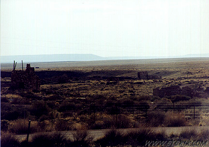
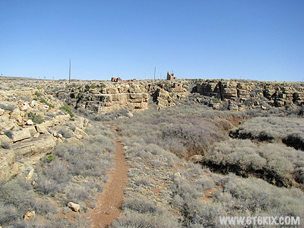
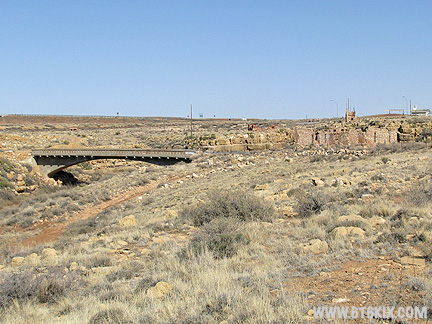
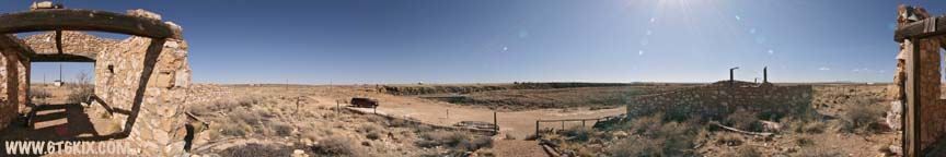
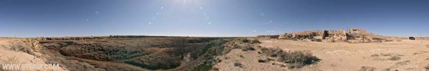
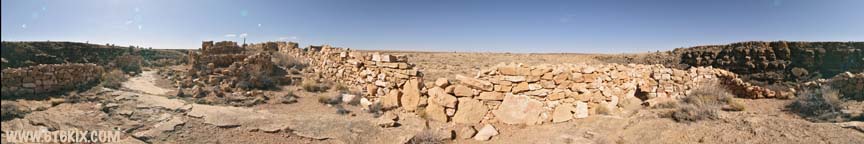
VR Panorama of the Querino Canyon Trading Post ruins. ('07) |
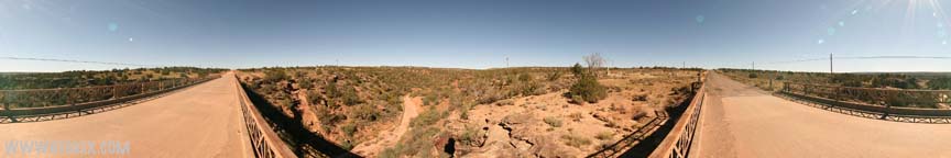
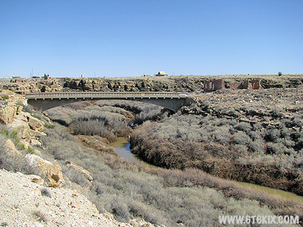
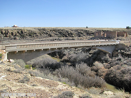
VR Panorama taken from the north side of the bridge next to the Querino Canyon Trading Post. ('07) |
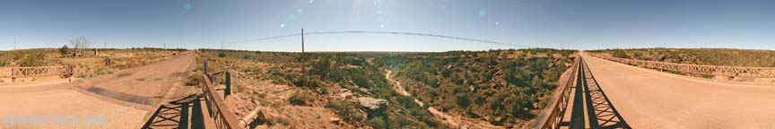
VR Panorama taken from the south side of the bridge next to the Querino Canyon Trading Post. ('07) |

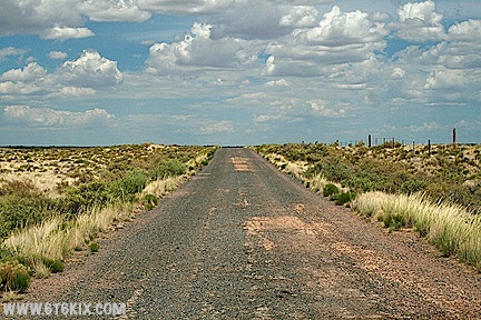
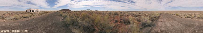
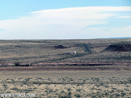
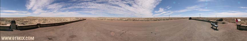
VR Panorama taken where suspected dirt '66 comes in from the east (originating from under I-40 near Navajo) and intersects Pinta Road north of I-40. It proceeds WSW to be cut by I-40 and then back WNW into the boundary of the Painted Desert and follows along paved 66 and then the south rim of the Painted Desert to the Painted Desert Inn where it proceeds westbound. It appears to be drivable by high clearance vehicles (which a Mustang is not!) ('07) |

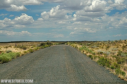
VR Panorama taken where paved '66 comes in from the east (Navajo) and intersects the trail from the Pinta Road exit off I-40. |
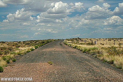
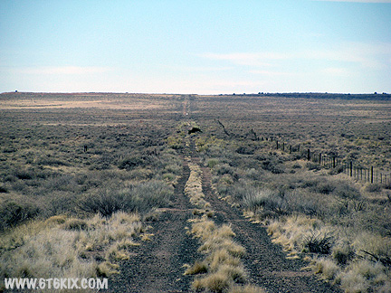
From where Pinta Road crosses 30's 66, you have a choice; east or west as both are blocked by fences you must return to Pinta Road. This photo is looking east down 66 from the Pinta Road intersection. ('08) |
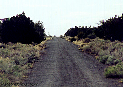
Continuing east towards Navaho, the road bed is in pretty good shape and 40 mph is easy. ('08) |
there are a few spots where the asphalt is breaking up along the edges. ('08) |
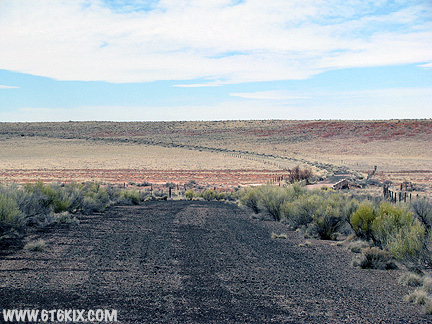
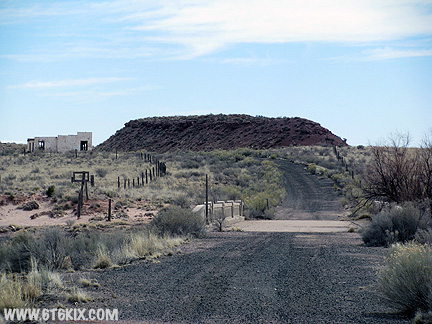
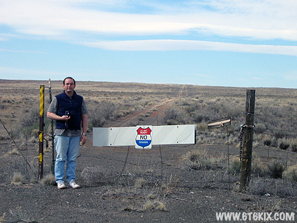
After a couple of miles, there is a fence with a barbed wire gate. I am not up on AZ trespass law so we stopped here. 66 continues ahead and angles SSE into Navaho where there is a barbed wire fence with no gate. ('08) |
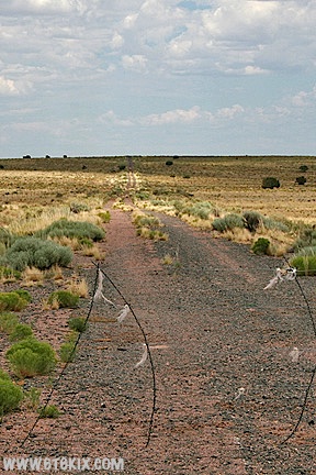
The road surface beyond the gate has devolved into tire ruts. ('08) |

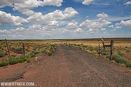
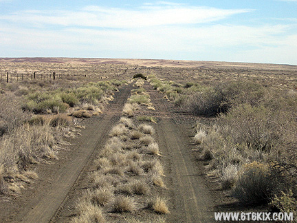
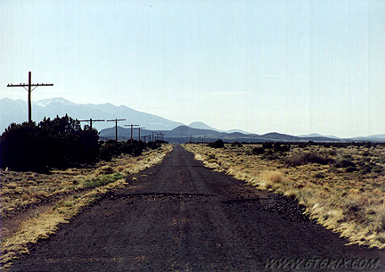
For a change of direction, here we are heading west from the Pinta Road intersection with 30's 66. The road surface here is also in good shape and 30-40 mph is easy. ('08) |
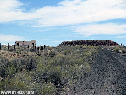
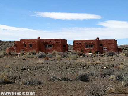
Still heading west. The Painted Desert Trading Post comes into view. ('08) |

Getting closer. ('08) |
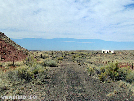
66 Curves around a small mesa. ('08) |

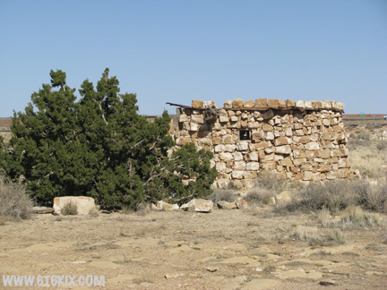
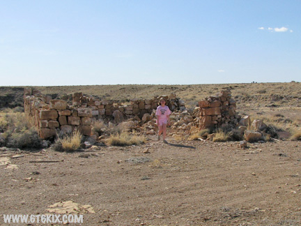
At last we have arrived. Most of the graffiti I remember from other pictures has faded. ('08) |

We found this outside the west side entry. ('08) |
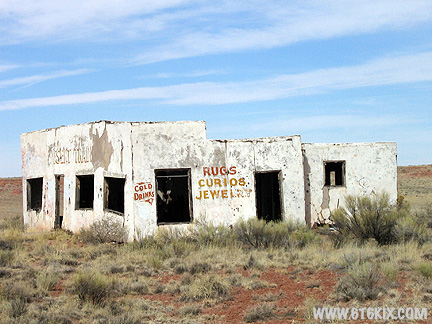
The painting on the east side is still pretty bright. ('08) |
The south (sun) side has faded and the surface has started to spall off so a lot of the letters are gone. ('08) |
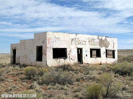
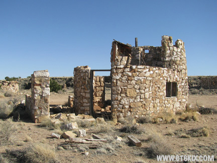
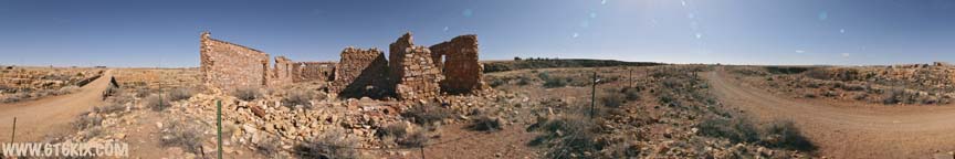
VR Panorama taken from the southeast corner of the Painted Desert Trading Post. The trading post is located on the |

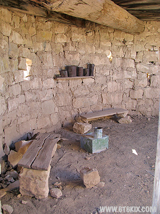
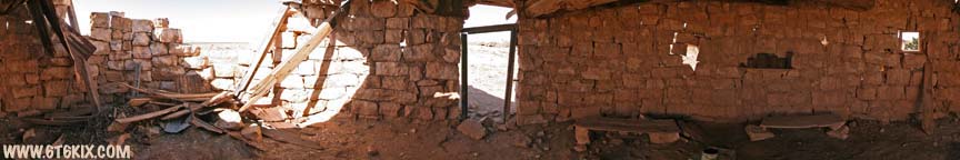
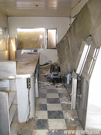
VR Panorama of the interior of the Painted Desert Trading Post. The building is essentially in ruins from time and |
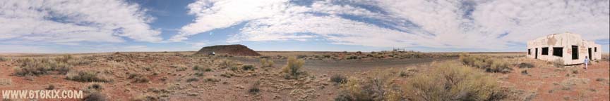
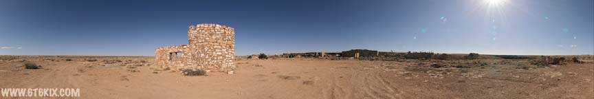
VR Panorama taken from the middle of abandoned 66 SW of of the Painted Desert Trading Post. |
Looking back up at the trading post from the west road. ('08) |
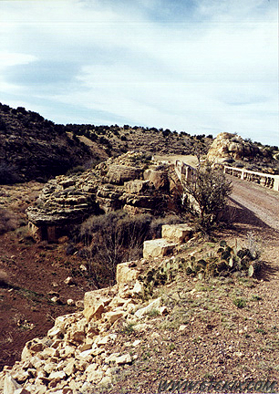
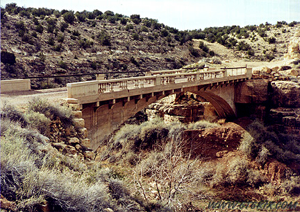
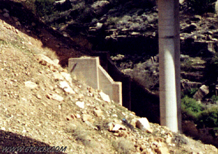
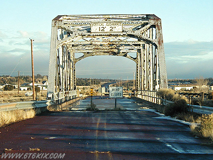
Heading down the hill the old bridge over the |
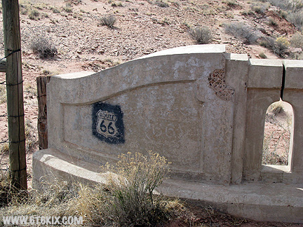
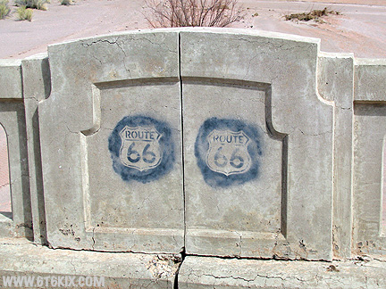
Some Roadie made themselves a stencil. This one shows up on bridges all through this area. Note the older faded one to its right. ('08) |
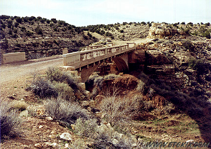
More decorations further onto the bridge. ('08) |
Looking back east over the bridge to the trading post. ('08) |
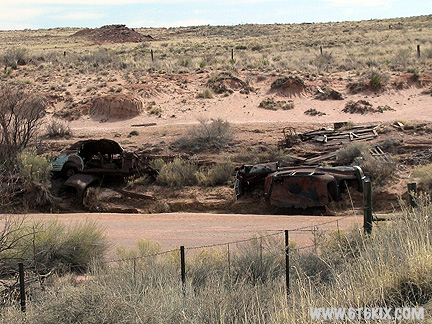
Dead autos dumped into the wash on the north side of the bridge. ('08) |
Looking back east at the outpost from 66 as it climbs the rising terrain to the west. ('08) |
A last look back before cresting the rise. ('08) |
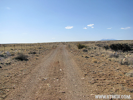
66 continues due west towards the Painted Desert. |
Looking back to the east from the boundary fence. ('08) |
Checking out the gate blocking 66 at the boundary of the Petrified Forest National Park. I guess if you cross here the black helicopters from Homeland Defense will show up. ('08) |
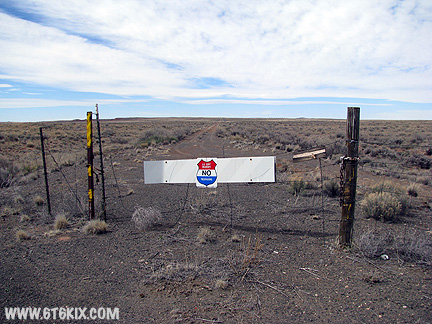
Another shot of the barrier without camera-boy. Yes it has a lock on the chain. ('08) |
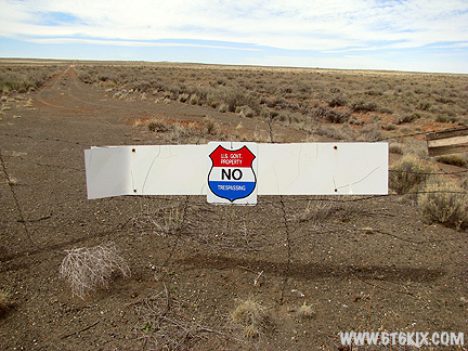
U.S. GOVT PROPERTY |

Main entrance to the Petrified Forest National Park. ('97) |

Looks like they redid the area around the sign. Pavement. curbs, and some petrified wood has been added. ('08) |

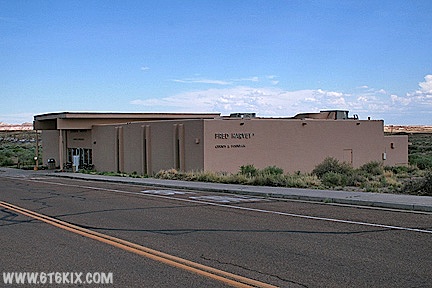
The Painted Desert Entry gift shop and restaurant are run by the Fred Harvey Company. The embossing on the glass says "Fred Harvey Trading Company Est 1876. ('08) |
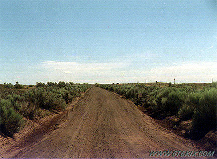
Route 66 entering park from the east. The pavement has been reduced so it is just dirt/gravel now (restricted access). ('97) |
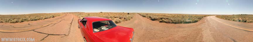
VR Panorama of where dirt '66 intersects the Painted Desert National Park road. ('07) |

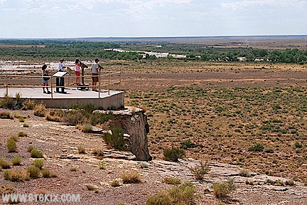
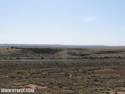
The south rim of the Painted Desert canyon from Tiponi Point using a 10X zoom. 66 can be seen running along the edge. Semi's are visible in the background on I-40. ('08) |
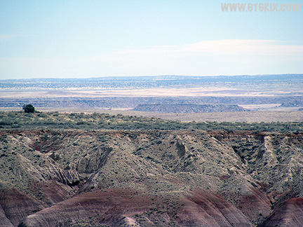
A view to the southeast from Tiponi Point. You can still pick out the trace of 66. ('08) |

The Painted Desert. '66 runs along the far rim of the canyon. ('97) |
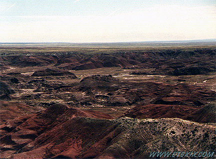
Another shot pointed further to the east. '66 is visible as a faint line on the far rim. ('97) |

VR Panorama of the Painted Desert from the overlook at Tiponi Point. Route 66 follows along the south edge of the canyon. ('08) |
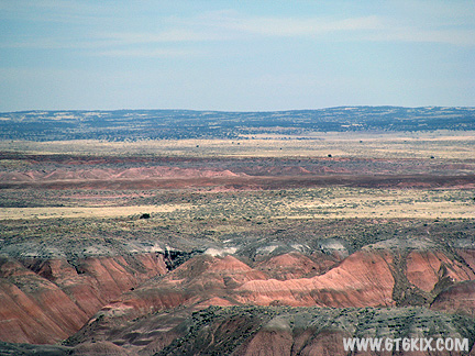
A view towards the Painted Desert Trading Post from 'No Name Point". ('08) |

VR Panorama of the Painted Desert from 'No-Name Point' (north of Tiponi Point). |

The Painted Desert Inn from the Tawa Point lookout. This vista gives a better idea of how strategically the Inn was located. ('08) |
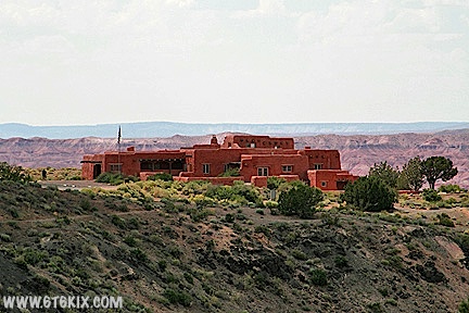
A closer shot of the Painted Desert Inn (ain't telephotos wonderful?) ('08) |

The Painted Desert Inn. This served as the original park entry. Now it is park offices. ('08) |
Employee housing across the road from the Inn. ('08) |
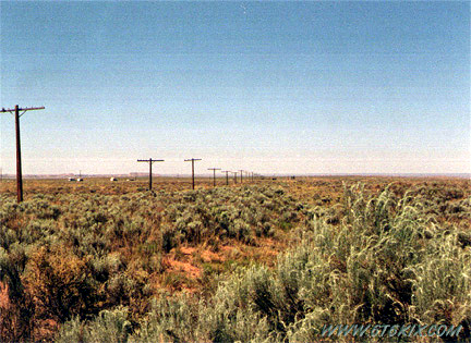
'66 leaving park to the west along the old poles. It continues straight until it goes under the interstate. ('97) |
Same shot from the interstate. ('99) |

The same piece of 66 as it approaches the interstate (where it is cut). ('99) |
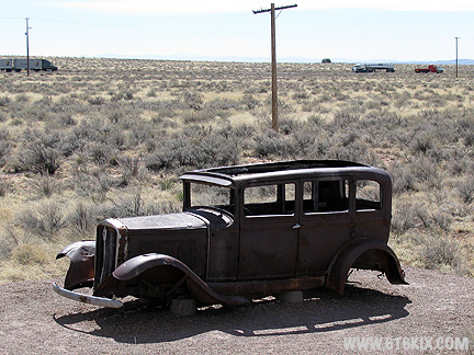
Old car from the 20's installed as part of the Route 66 kiosk located where the park road crosses 66 on the west side of the park. ('08) |
VR Panorama of the north end of the Petrified Forest Route 66 kiosk along the western side of the park road. ('08) |

VR Panorama from the south end of the Petrified Forest Route 66 kiosk along the western park road. ('07) |

VR Panorama from Tepees area of Petrified Forest National Park. |
Michelle takes a look through the telescope at the Newspaper Rock overlook. ('08) |

The view from the Newspaper Rock overlook. ('08) |
Some rock carving at Newspaper Rock. ('08) |

The sun was so bright that it was difficult to spot the rock etchings. ('08) |

I could find two spots on the side of boulders (they are easier to see in the photos than in person). ('08) |
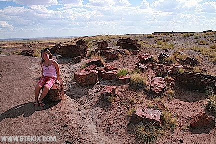
Entry to the Crystal Forest hiking path. ('08) |
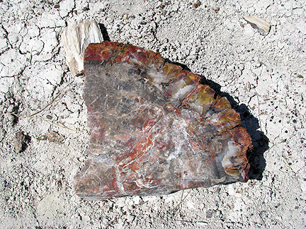
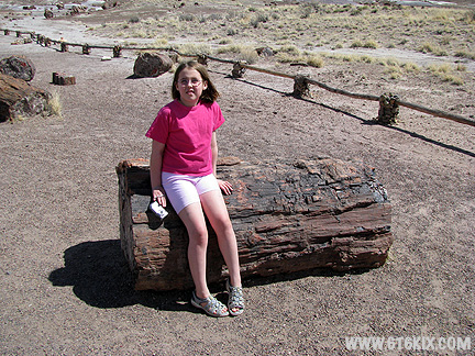
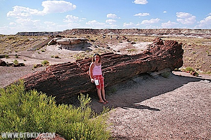
Anyone for a slice of petrified pizza? ('08) |
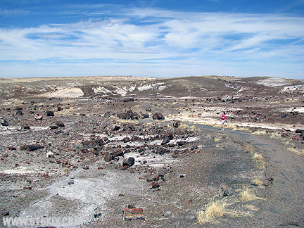
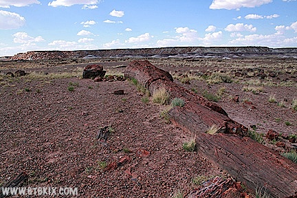
The area is covered literally covered with petrified wood from gravel size to full logs. ('08) |
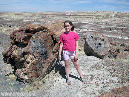
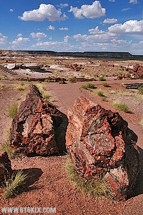
A size comparison. ('08) |
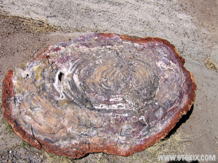
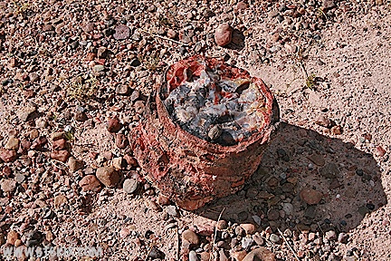
The growth rings can be counted. ('08) |
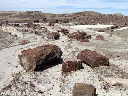
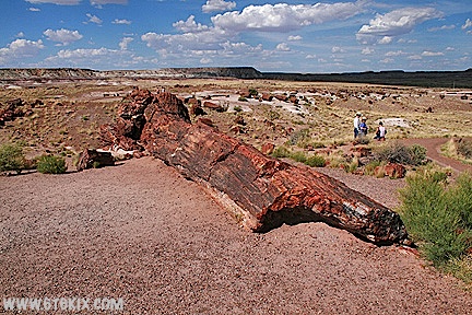
Literally tons of rock. ('08) |

Some logs are almost complete. ('08) |
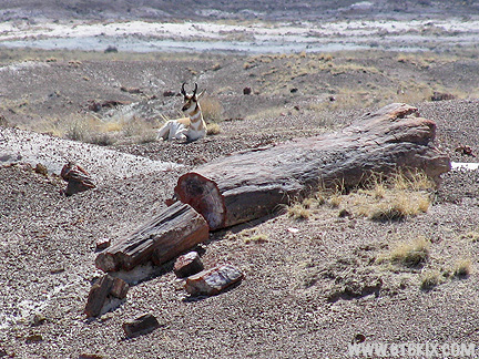
A visiting antelope. ('08) |

VR Panorama from the Crystal Forest in Petrified Forest National Park. The are numerous whole petrified logs |

Another VR Panorama from inside the Crystal Forest area of Petrified Forest National Park. |
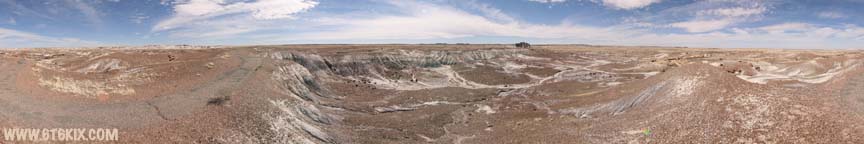
A VR Panorama taken from at the south end of the Crystal Forest hiking path. This area doesn't have as many |
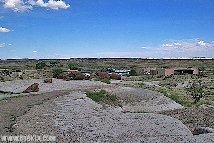
Considering that it is off the beaten path, the south entry/exit station (Rainbow Forest Museum) at the Petrified Forest National Park is a bigger complex than I would expect. It has an extensive trail system all around it. ('08) |
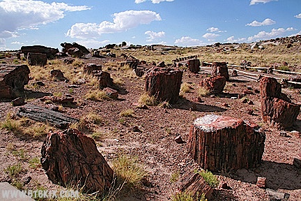
'The Giant Logs Trail' behind the museum has some of the largest petrified logs in the park. ('08) |
Not as extensive a variety and volume of petrified wood as the Crystal Forest area, there is still a respectable amount to be seen. ('08) |
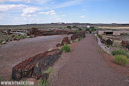
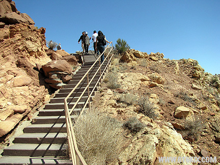
The area was stabilized in the past and has paved pathways and stairs for the steeper grades. ('08) |

The trails are segmented so you aren't restricted to doing the entire hike. ('08) |
The trails pass right by the largest pieces. ('08) |
As I recall, this one is called 'Old Faithful'. ('08) |
In 1962 it was struck by lightning, was split and the Park Service repaired it. A no-no today. ('08) |
A piece of petrified branch. Not much petrified wood of branches is found. It is speculated that the branches were stripped off in flood waters before the logs were deposited in their present position. ('08) |
Lots of fragments. ('08) |
The Rainbow Forest Museum complex also has a Fred Harvey facility. ('08) |

Entering Holbrook from the south (coming from the south Petrified Forest entrance) the Indian Rock Shop is found at the intersection with Route 66 coming from the east. ('97) |
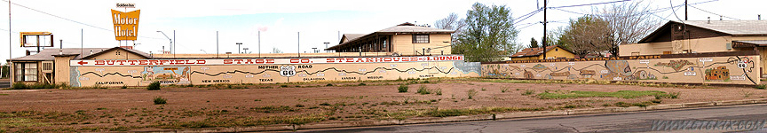
A wide-angle composite of a 66 themed wall mural in Holbrook. ('03) |

The Road Warrior is ready for a Road Nap. ('03) |
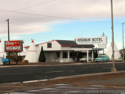
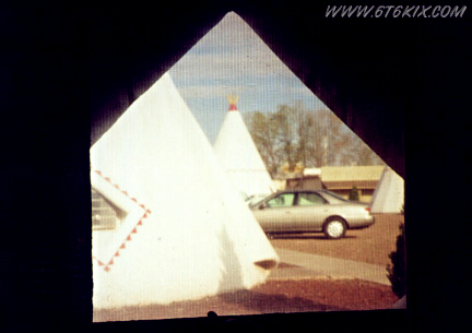
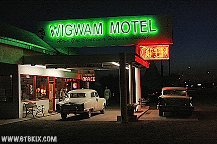
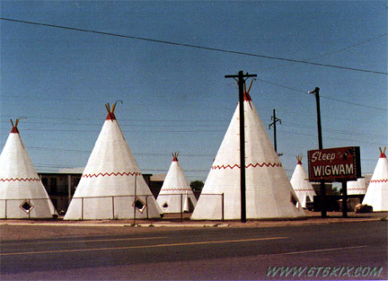
Wigwam Motel Office in Holbrook. ('03) |

Wigwam Motel office Neon ('99) |

One of the owner's restored cars in front of a Wigwam. ('99) |
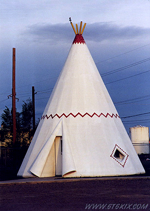
Wigwam #9, where we spent the night. ('99) |
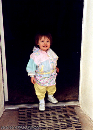
Michelle checking out the doorway. ('99) |

Michelle and Dino outside the Wigwam. ('99) |

David and Michelle in front of Wigwam #9. ('99) |
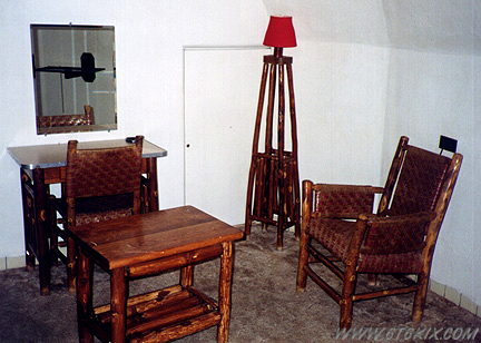
Retro furniture inside the Wigwam (nobody is going to walk off with this stuff, those are real logs). ('99) |
View out the window. ('99) |
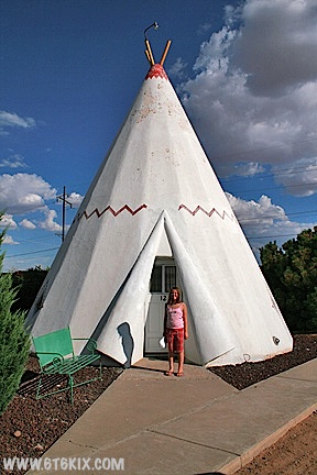
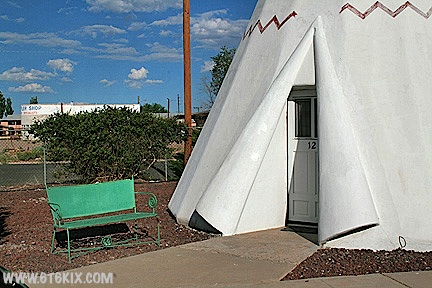
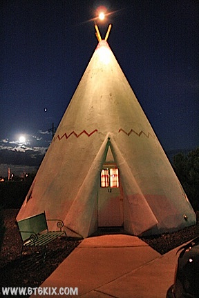
This trip we stayed in Wigwam #12. ('08) |
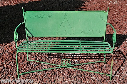
Outside the door is a fancy iron park bench. ('08) |
A nice restful spot in the evening to watch the sunset. ('08) |
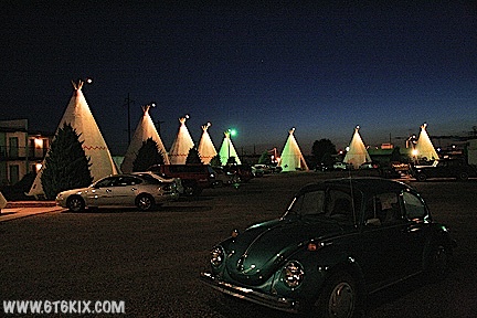
After dark, the neon comes on. ('08) |

More neon. They filled up fast so you may want to make reservations. ('08) |

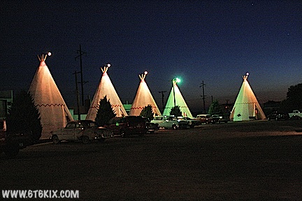
A full moon rising over a Wigwam. ('08) |

Night photo of the Village. ('08) |
Each Wigwam has a classic car parked in front of it. ('08) |
Our Wigwam (#12) under a full moon. ('08) |
Another night shot of the Wigwam Motel. ('08) |
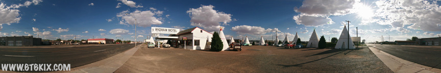
A VR Panorama of the Holbrook Wigwam Motel Office from the NW corner of the complex. ('08) |
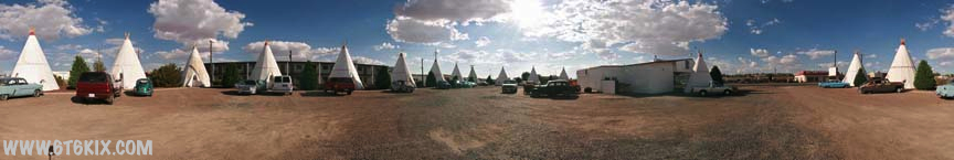
Another QTVR taken from the SW corner of the Holbrook Wigwam Motel complex in front of Wigwam #12 where we stayed. ('08) |
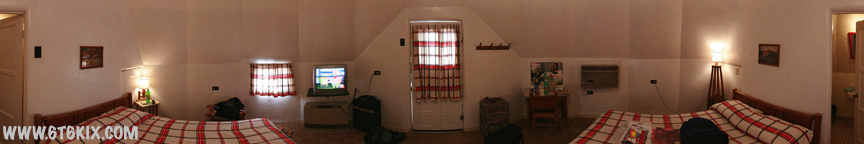
Ever wondered what the inside of a Wigwam looks like? Here is a QTVR of the inside of Wigwam #12 at the Holbrook |
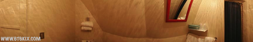
Another QTVR inside of Wigwam #12 at the Holbrook Wigwam Hotel. |
Shot from east of the Wigwams. ('97) |
Original Route 66 sign in the Stagecoach restaurant (down the street from the Wigwams) ('99) |

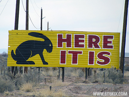
Here it is! The Jackrabbit Trading Post. ('97) |
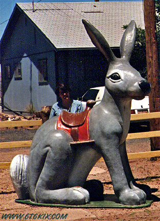
The sign has been refurbished but the bunnies were removed. They said that they are waiting for metal ones to arrive. ('08) |
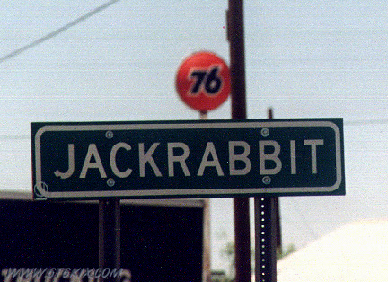
66 has some odd names along it's length. ('97) |
Allison hiding behind the big rabbit. ('97) |
Another silly tourist photo. ('97) |
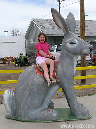
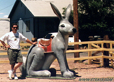
A new member of the Jackrabbit club. ('08) |
|
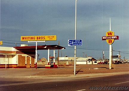
Whiting Brothers gas station in Winslow. ('99) |

Close up of the Whiting Brothers sign. ('99) |
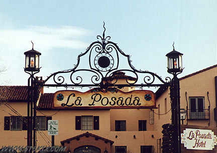
Front gateway to the restored La Posada Hotel in Winslow. ('99) |

Angle shot of the La Posada. ('99) |
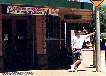
Standin' on the corner in Winslow Arizona. Didn't see any flatbed Fords though. ('97) |
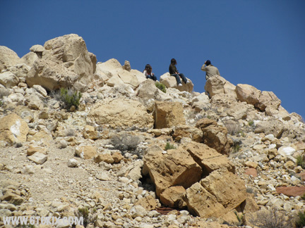
The Barringer Meteor Crater from the south. The rim rises 120-150 feet above the surrounding plains. ('08) |
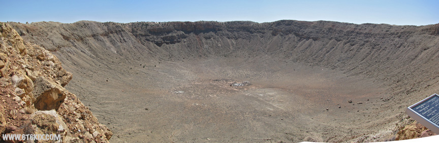
A wide-angle view inside the crater. For perspective, the crater is 550 feet deep and 4100 feet across. Over the years, it has |
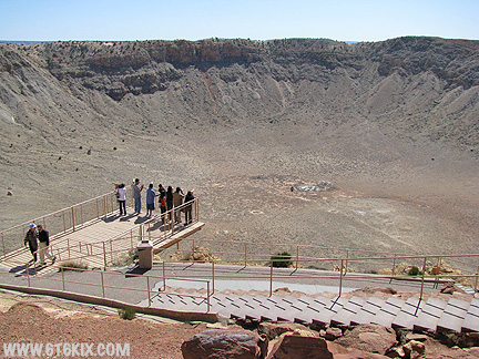
They built an observation platform inside the rim. It has fixed telescopes marking the various features inside the crater. ('08) |

At the bottom, a mine shaft was sunk looking for the remains of the meteor. Apparently meteoric iron/nickel was worth a lot since it had diamonds and a high platinum content. For perspective, there is an astronaut and flag in the lower right corner. ('08) |
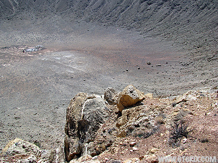
A view into the crater. ('08) |

A 10x zoom of some boulders. Can you find them in the photo to the left and on the larger photo above? The big one is 3 times as tall as an adult. ('08) |

A view of the rim past the observation platform. Note the rock marked by the red arrow. ('08) |
Close-up of the rock marked on the photo to the left. This boulder is as large as a two story house. ('08) |
A close-up of the far rim. When they figured out that the meteor came in at an angle, they figured the meteor must be under the south rim so they drilled to find it. Unfortunately, the meteor was mostly destroyed on impact and scattered across the plains around the crater. ('08) |
Be ready for some climbing. ('08) |
A view of an observation area up the crater wall from the observation platform. ('08) |
A close-up of the observation area on the rim. ('08) |

The largest remaining piece of the 150 foot meteor. ('08) |
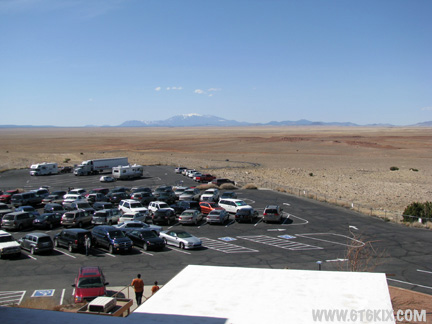
A view from the visitor center. The road leading north to 66 and the San Francisco Peaks can be seen. ('08) |

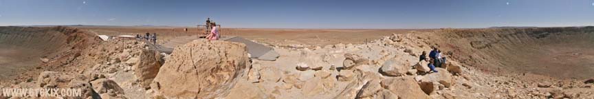
VR Panorama taken outside of the Barringer Meteor Crater visitor center. Not a bad sized hole for a 150 foot piece |
VR Panorama taken at the highest observation point on the rim of the crater. The roof of the visitor center and an |
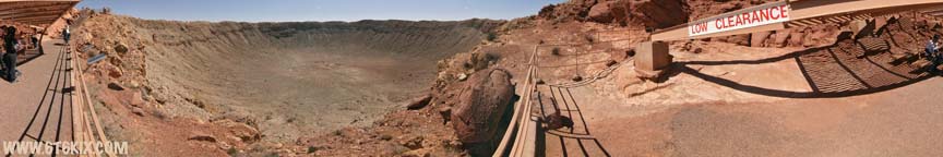
VR Panorama taken from the observation area that is built down inside the crater rim. ('08) |
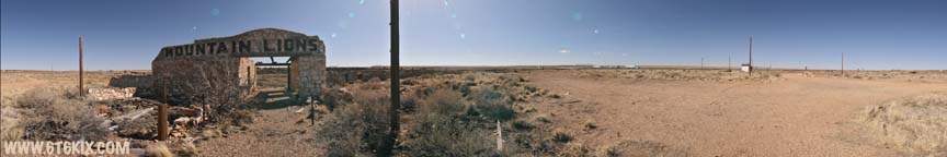
Two Guns from the exit barrier. This is as close as we could get without trespassing. ('99) |

Drive by shot of Two Guns. 'Mountain Lions' can still be seen on the old menagerie. ('97) |
|
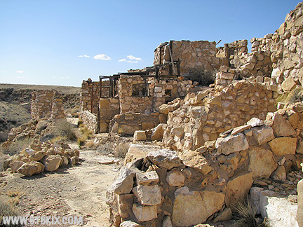
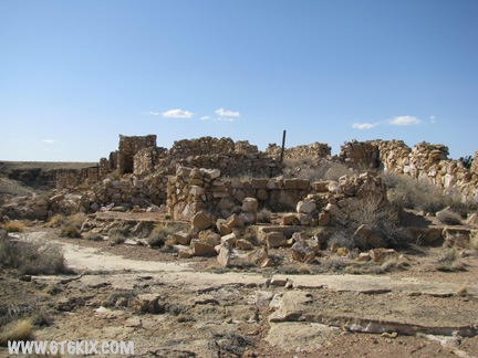
More ruins in Two Guns. ('97) |
Painted storage tanks at the closed gas station/KOA Campground at the exit. ('08) |

The barriers around the Two Guns ruins have been removed. All of the paths 66 took into town are open. The newer menagerie building is one of the first ruins you encounter when entering town from the 40's 66 pavement. ('08) |
The most modern building remaining is behind the remains of the most recent trading post from the 50's. Note the painting. ('08) |
An odd find. I wonder how it would look in my house. ('08) |
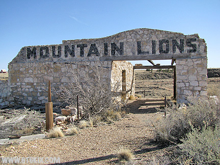
The facade of the 'Mountain Lions' menagerie building. ('08) |
A view of the 20's 66 bridge from the edge of Canyon Diablo behind the 'Mountain Lions' building. ('08) |

A view of the back of the 'Mountain Lions' menagerie building. Many of the cages are still visible. ('08) |
A closer view of the bridge. ('08) |

A look back at the menagerie building from the bridge. ('08) |

The 20's Two Guns Trading Post building on the west end of the bridge. ('08) |
A view to the east from the bridge. These are the original buildings in Two Guns. ('08) |

A closer view of how they commanded the route down into the canyon. ('08) |

Closer yet. They would make a nice summer cottage. ('08) |


A look back at the bridge from the south side. ('08) |

A view of the bridge and Trading Post ruins. ('08) |
A another view of the bridge and Trading Post from further west on 20's 66. ('08) |

A look north across the canyon at the back of the 'Mountain Lions' menagerie building. ('08) |
The ruins of the Texaco gas station tower. ('08) |

The Texaco building from another angle. Note the external stairway to the top floor. ('08) |
A round rock building southeast of the Texaco. ('08) |
I could find no indication of what its original purpose was. The heavy construction (note the ceiling beam) would imply some kind of secure storage. It looks like it is now being used as a campsite. ('08) |
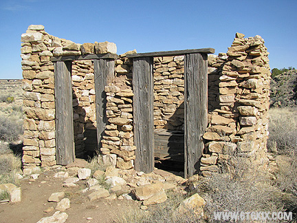
A heavy-duty outhouse. All the modern convenience of a 2x2 holer. ('08) |
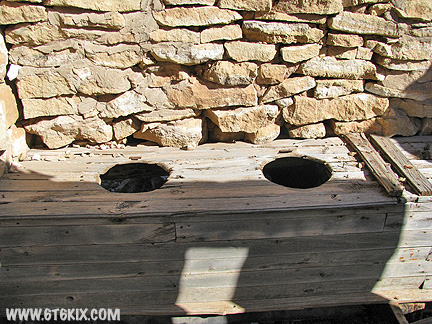
Take a seat. ('08) |
Back of the older menagerie building to the south of the Texaco tower. This one was built right on the rim of Canyon Diablo. ('08) |

Exploring the east end of the building. ('08) |
A look back at the main building. There are the remains of numerous cages all along the back of the building. ('08) |
Another ruins on the west end. ('08) |
1920's Route 66 heads west out of town for a rendezvous with I-40. The Two Guns history days that there is a building built by Billy the Kid down the canyon. ('08) |
A view of Two Guns from the north side of I-40. It doesn't stand out much (no wonder it worked so well as a hiding place for the Indians). ('08) |
|
|
VR Panorama taken from the back of the 'Mountain Lions' menagerie building at the top of the stairs. The remains of numerous cages can be seen along the back of the building and also the 1920's 66 concrete bridge over Canyon Diablo can be seen to the south. ('08) |
VR Panorama taken at the edge of Canyon Diablo behind the 'Mountain Lions' menagerie building. There is also an old dump with a large amount of old broken bottles and rusted cans. The 1920's 66 bridge over the canyon and the original trading post can be seen to the east. ('08) |
VR Panorama taken at the south end of the bridge in front of the Two Guns Trading Post building on original Route 66 through the town. The post picked up a lot of business by locating right on the curve after crossing the bridge. ('08) |
VR Panorama taken inside of a small yet stoutly built round building west of the bridge. No particular purpose was evident but its heavy construction implies some kind of secure storage/armory or perhaps a ceremonial hogan. ('08) |
VR Panorama taken from the west side of the famous Two Guns 'Tower' Texaco station. The original menagerie building can be seen to the south and the round building and rere' dorter (2+2 holer) are to the right of the station. ('08) |

VR Panorama taken inside the entry hall in the original menagerie building. The tower of the Texaco station can be seen through the front doorway and Canyon Diablo out the back. ('08) |

VR Panorama taken inside of one of the larger rooms in the menagerie building. Canyon Diablo can be seen out the windows in the back of the building. ('08) |

VR Panorama taken outside the back of the older menagerie building. Numerous cages can be seen lining the back of the building and the edge of Canyon Diablo is right on the pathway. ('08) |
VR Panorama in an open area on the east end of the menagerie building. The entire back of the building follows along the vertical drop into Canyon Diablo. ('08) |
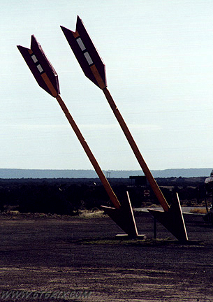
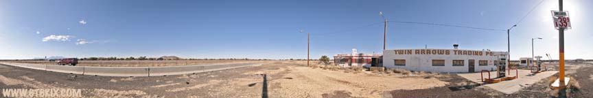
The famous arrows at the Twin Arrows Trading Post. ('99) |
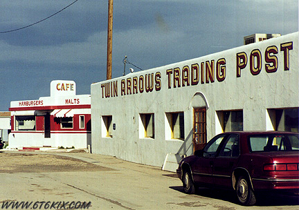
The Twin Arrows Trading Post. ('99) |
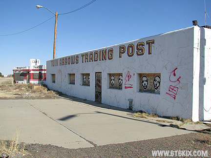
A newer shot. From the outside the buildings are in pretty good shape. ('08) |

Another view from the Valentine Diner end. ('08) |
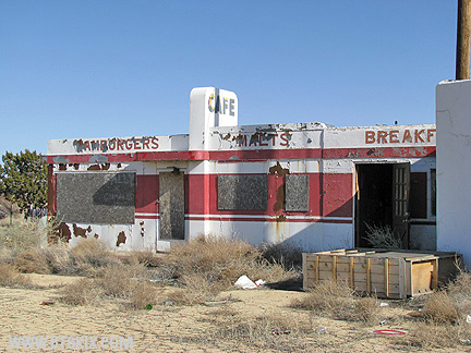
A closer view of the Valentine Diner. The paint is peeling and rust is showing through. ('08) |
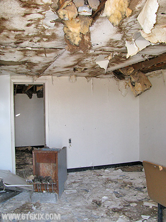
A look inside the doorway shows a lot of water damage from the failed roof. ('08) |
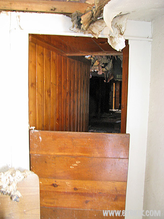
Looking through the connecting hallway shows the same problem in the main building. ('08) |
The east end of the Valentine Diner is in better structural shape with most damage coming from vandalism. ('08) |

Jeeze, I wish <sigh> ('08) |

A mural on a small building on the west end. ('08) |

The arrows have seen better days. ('08) |

Neither has an arrowhead. ('08) |
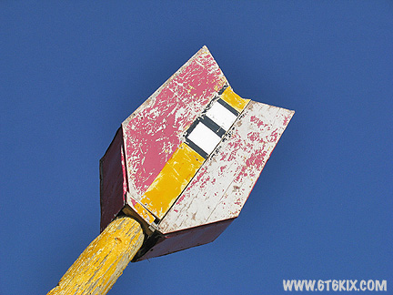
One has its feathers. ('08) |
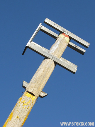
One doesn't. ('08) |
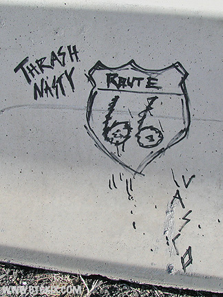
Some Roadie graffiti. ('08) |
VR Panorama taken at the east end of the Twin Arrows Trading Post. The exterior of the buildings look good with only some peeling paint evident on the Valentine Diner. Note the price of gas posted on the pole <sigh> ('08) |
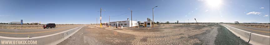
Another VR Panorama at the Twin Arrows Trading Post this time from the west end of the compound. The arrows aren't doing so good and are almost down to bare poles. ('08) |

Padre Canyon from I-40. The concrete barrier blocks the view to the point that you can hardly tell it is there from the interstate (and this photo was taken from a high ground clearance vehicle so from a normal car you would see even less). ('03) |
The north side of the old old 66 bridge over Padre Canyon. This is the same style as the better known (and photographed) one at Two Guns. This is looking east. ('99) |

The south side. This section of 66 has no access from the east and must be driven in from Winona. ('99) |
The north side railing has been replaced with a railroad tie. ('99) |
The bridge span can be seen better here. Padre Canyon has near vertical walls. ('99) |
More of the canyon can be seen here. The first misstep is a doozy. ('99) |
Looking to the south where old old 66 snakes along the west rim of the canyon. This trip is for 4-wheel vehicles or dirt bikes only. ('99) |
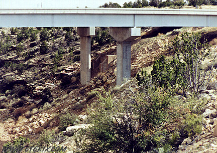
To the south, old old 66 meets up with recent 66. The interstate was built right over 66. ('99) |
 The bridge abutments from 66 are under the newer interstate pylons. ('99) |
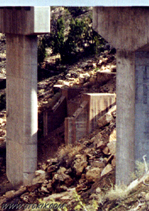
 This is the east side of the canyon where the interstate also conceals an abutment. ('99) |
 A close up of the east side. ('99) |
 Old old 66 snakes up out of the canyon and heads west towards the interstate. ('99) |
 Some off-road driving must be done to bypass the obliterated pieces of 66. This is the crossing over a washout. The culvert comes from underneath the interstate. There is a small reservoir over there that drains through here so it probably wouldn't a very good idea to try this spot after any rain. ('99) |
 Here 66 comes out from under the interstate (the previous bridge footings are just over this rise). ('99) |

The Road is in amazingly good shape here. ('99) |

A curve in 66 is obliterated by the interstate so it is back to 4-wheeling. This is where 66 comes out from under the interstate heading west. ('99) |
Another few miles of old blacktop are starting to show their age with broken sections working their way across from the edges. ('99) |
Further west, the blacktop has completely broken up and has been reduced to badly wash-boarded gravel. ('99) |
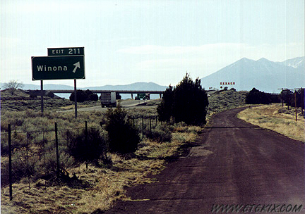
Closer to Winona, maintenance has been continued so it is a better drive. The Winona exit off the interstate is ahead. ('99) |
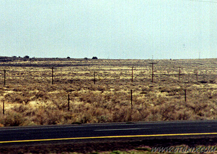
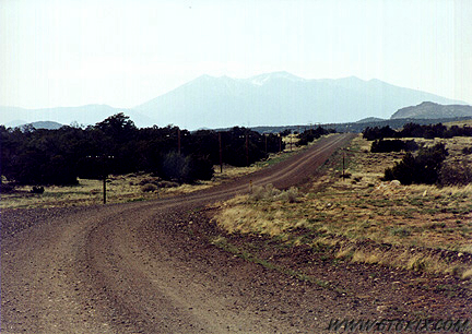
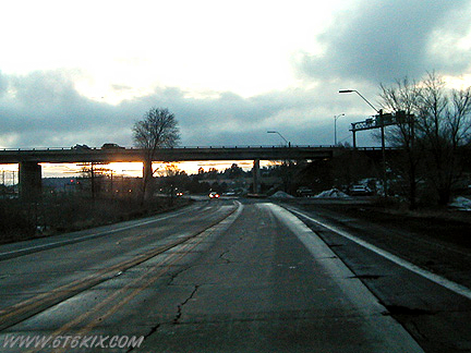
 Looking east along 66 between Flagstaff and Winona. The interstate is on the right. ('99) |
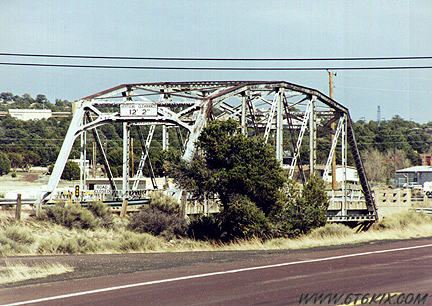
Continuing from Winona towards Flagstaff. A bypassed 66 bridge alongside the current roadbed ('99) |
Same bridge from the turnoff. The old paint stripes still show. ('03) |
|
ROUTE 66 SIDE TREK
Photos and QuickTime VR Panoramas from Walnut Canyon National Monument located just south of the 40's Route 66 alignment about 5 miles east of Flagstaff. Walnut Canyon features a museum and numerous hiking paths along the rim and down into the canyon through cliff dwellings from 1200 years ago. Definite photo op. |

Coming into Flagstaff on the newer alignment (from the I-40 exit) ('03) |
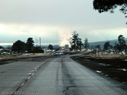
66 winds it's way into Flagstaff in the East end industrial area. ('03) |
More on the 50's alignment. ('03) |
Approaching the Purina Plant and RR track on left. ('03) |

Backside of the new mall ahead (it faces the older 66 alignment). ('03) |
Bridge over 66 and RR tracks (on left side). The older 66 and 1950's 66 join on the other side and continue into Flagstaff. ('03) The bridge/intersection of 40's 66 with 30's 66 has been completely redone. Hats of to ADOT as they saved as much original pavement as they could. ('08) |
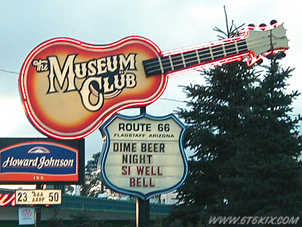
The Famous Museum Club. ('03) |

The Museum Club in Flagstaff. The entryway is made from a single forked tree trunk. ('03) |
Wall mural inside the Flagstaff Hotel. ('03) |
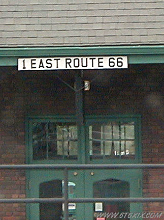
Address on Flagstaff Train Depot. ('02) |
|
Photos and QuickTime VR Panoramas from the 2007 Route 66 Days in Flagstaff are available in the events area.
|
|
Photos and QuickTime VR Panoramas from the 2008 Route 66 Days in Flagstaff are available in the events area.
|
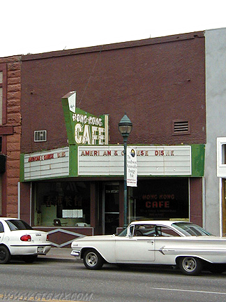
Hong Kong Cafe in old movie theater in Flagstaff. ('02) |
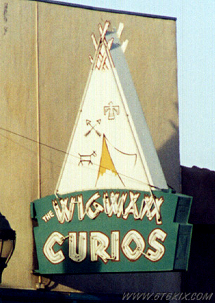
Wigwam Curios in downtown Flagstaff across from the train depot. ('99) |
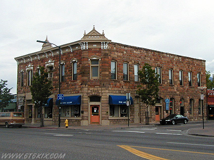
Old Bank on corner opposite from Train Depot. ('02) |
Storage Building next to main Depot building. ('02) |

Steam Locomotive next to depot. ('02) |

Close-up of Engine. ('02) |

Restored hotel (now a bar) one block off of 66. The downtown area has seen a lot of restoration and there are many shops and restaurants now. ('02) |
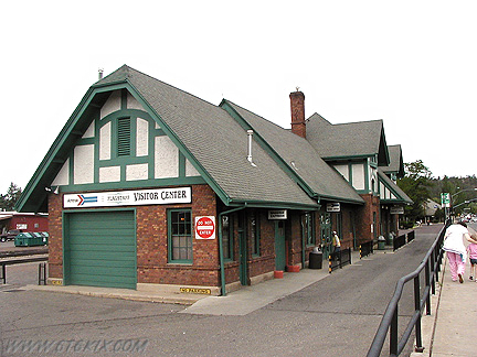
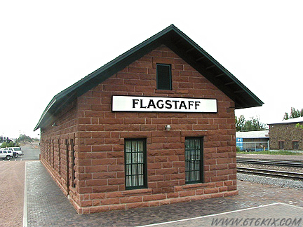
Main train depot. Amtrack and a visitors center are inside. ('02) |
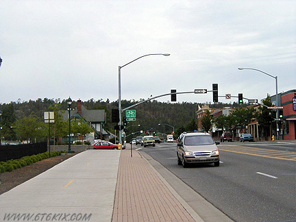
66 outside of the station. It serves as the main road through downtown. ('02) |

Old Downtowner Hotel sign in Flagstaff. ('02) |
.
|
Click HERE to view photos and QTVRs from a Grand Canyon Side Trip
The Grand Canyon has always been associated with Route 66 and is a favorite side trip. The main Park area is about an hour due north of Williams on AZ64. For a better option, leave Flagstaff to the north on US89 and enter the park from the east on AZ64, enjoy the drive along the south rim to the main park area, and then return to Flagstaff via AZ64/US180. This keeps you from having to backtrack inside the park and/or miss the Route 66 alignments between Flagstaff and Williams. . |
.
Click HERE to continue to West Arizona Route 66
|
|
|
|
|
|
|
|
|
.
.
|
|
|
|
|
|
|
|