BELLEMONT TO CALIFORNIA BORDER
. .

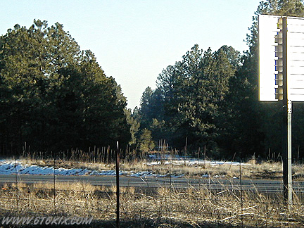
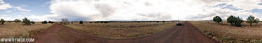
VR Panorama taken at the east end of 40's 66 at Bellemont. Beyond the barrier, the I-40 berm covers 66 east to Flagstaff. ('08) |

Looking back towards Bellemont from the east terminus of the 40's pavement. ('08) |

An old gas station east of town. ('08) |

The 20's roadbed crosses under the 40's pavement and proceeds northeast under I-40. You can see where it is blacktopped and still in use on the other side. ('08) |

The 30's roadbed comes out from under the 40's pavement and proceeds SW into the Bellemont warehouse area. It comes out the other side. ('08) |

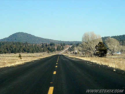
The 40's pavement continues west. ('08) |

Looking back east from the 20's and 30's roadbed where it continues WNW out from under the warehouses. ('08) |
|
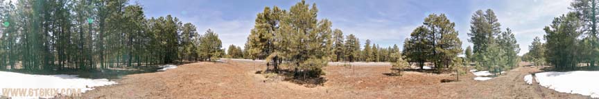
VR Panorama taken from 20's and 30's 66 on the west side of Bellemont. The warehouses that can be seen in the distance were built on the south side of 40's 66 but right in the middle of the abandoned 20's and 30's 66 roadbed. ('08) |


A small dump on the south side. ('08) |

How long has it been since you've seen one of these? It must be an old one since someone used a church-key opener on it. It has an aluminum top but still has steel sides. ('08) |

A view to the east from about the halfway point on the abandoned 20's & 30's roadbed. No pavement is evident in this area. ('08) |

Approaching the 40's pavement, the trees have begun to reclaim the road. ('08) |

Some remaining red pavement near where it crosses the 40's pavement. In this area the 20's and 30's roadbeds begin to diverge and enter the forest on the north side of the 40's pavement on separate tracks. ('08) |
|
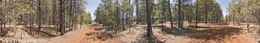
VR Panorama taken from the abandoned 20's & 30's roadbed closer to where it crosses the 40's 66 pavement. ('08) |

|
VR Panorama taken on the south side of of the 40's pavement where the 20's & 30's roadbed crosses it heading to the northwest. |


Black blacktop where the 30's roadbed comes out from under the 40's pavement complete with some Roadie graffiti. ('08) |
|
|

|
VR Panorama taken from the middle of 20's 66 just north of where it crosses the 40's 66 pavement. |


Where the 20's roadbed enters the forest it still has a solid red colored blacktop surface. ('08) |

20 yards north on the 20's alignment, a blacktopped spur cuts west to connect with the 30's roadbed. ('08) |

The builders of the 20's Route must have had leftover blacktop that they dumped next to the road. It is over 2 feet deep. ('08) |

I first thought this was a filled-in concrete culvert under the 30's route, but on closer examination it is an undated cattle guard. The remains of both end fence posts and a small amount of barbed wire are still there but no other fencing is evident. ('08) |
|
VR Panorama taken off the south side of the 30's roadbed where a cattle guard has been installed across it. There is no evidence of any fencing except some old barbed-wire and the wood fence posts that were attached to the crossing. The connecting road from the 20's roadbed connects in just to the left of the cattle guard. ('08) |


The 30's alignment continues northwest. ('08) |

Eastbound I-40 cuts the 30's roadbed at this point. It can be seen to continue on the other side through the V cut in the trees. ('08) |
|
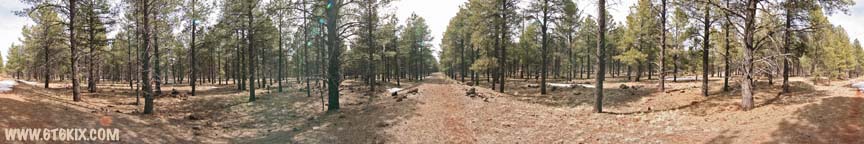
VR Panorama taken further north along the 30's roadbed. I-40 and the cut through the trees beyond can be seen ahead to the north. ('08) |

|
VR Panorama taken where the 30's roadbed is cut by eastbound I-40. It can be seen to continue on the other side. ('08) |

Walking east a short distance along I-40, 20's 66 is also cut by I-40. |

Looking back south, the 20's pavement is seen to be in pretty good shape. The road is being used as a dump for dead trees. ('08) |
|
VR Panorama taken where the 20's roadbed is cut by eastbound I-40. The red asphalt is in pretty good condition here. The roadbed is being used as a dump for fallen trees. ('08) |

|
The 20's roadbed comes from under I-40 and continues north. Westbound I-40 is in the foreground and a semi can be seen on the eastbound lane beyond. ('08) |

Here is the same view but from further up the '20's alignment. You can see all the way southeast through to the clearing. ('08) |


Looking back northwest as 20's 66 continues. This stretch can be driven but does dead-end on private property. ('08) |
|
VR Panorama taken from the 20's 66 roadbed north of westbound I-40. This section is drivable in dry conditions but dead ends on private property before tieing back into the 30's roadbed. ('08) |
|
A short distance to the west along the north frontage road, 30's 66 comes from the south under I-40 to continue north as a paved road. ('03) |
The same shot but from further to the right. The path of 30's 66 isn't as distinct as the 20's path as there is a slight bend near where it crosses the 40's alignment on the far side of the interstate. ('08) |

The north side frontage road turns north on the 30's roadbed and continues into the Kaibab National Forest. ('08) |

A rearview mirror shot of 66. ('08) |

The 30's Route curves west and the pavement ends where it becomes a private road (can be driven). ('08) |

Further north (along where the pavement turns north in the previous pic) the 20's alignment comes out of the forest from the east. ('08) |

The 20's roadbed continues west across an open marsh area. ('08) |

A view of the San Francisco Peaks from 30's 66. The line of 20's 66 can be seen crossing the marsh. ('03) |

20's 66 crossing the marsh. ('08) |

A close-up of the 20's roadbed. ('08) |

The 20's roadbed cuts west through the trees up the hill from the marsh. ('08) |

20's 66 roadbed comes in from the east and merges into the 30's roadbed. |

The 20's roadbed diverges and merges back into the 30's Route numerous times. ('08) |

A view of 20's 66 paralleling the 30's roadbed. ('08) |

Another 20's 66 merge into 30's 66. ('08) |

Between Flagstaff and Williams, 66 is oftentimes dirt. Sometimes it is on private land too. ('03) |


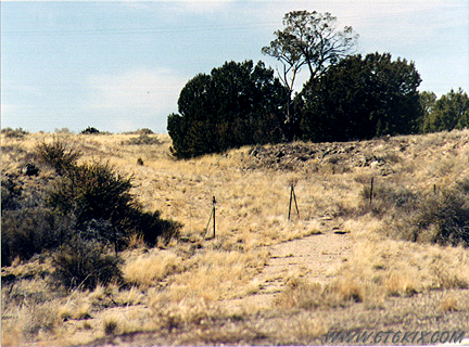
An alignment of Old-old 66 in the Coconino Forest that has been turned into a hiking trail. ('03) |

Kaibab National Forest Route 66 Tour sign at the trail head. The section on the left marked as a return to the interstate is incorrect; if you cross to the south side and take Mountain Man Road into Williams you are on the 20's alignment. ('08) |

A newer view of the 30's 66 hiking trail head. ('08) |

Just to the left of the fancy trail head for 30's 66, 20's 66 enters the forest as an nondescript opening in the trees. ('08) |
|
VR Panorama taken at the parking area for the Kaibab Forest Route 66 hiking & biking trail. The 30's roadbed (to the right of the Mustang) and the 20's roadbed (to the left) can be hiked to where they tie back into the 40's roadbed. To the east the combined 20's & 30's roadbeds (currently in use) come from the east and to the far left of the Mustang the current pavement can be seen to continue to tie into the 40's route. ('08) |


A view west on the 30's 66 hiking trail. The curbing of a concrete culvert can be seen. ('08) |
A view west on the 20's 66 hiking trail. ('08) |
|
Ummm, mountain lions on 20's 66? ('08) |

30's 66 culvert through the forest. ('08) |


|
VR Panorama taken halfway down the 30's roadbed where a concrete culvert is located. ('08) |

|
VR Panorama taken off the south side of the 30's roadbed with a better view of the concrete culvert. I couldn't find any date in the concrete. ('08) |

|
VR Panorama taken from the 20's roadbed directly south of the 30's concrete culvert. If you look carefully, the culvert can be seen to the north and the 40's roadbed (still in use) can be seen to the south. ('08) |

An old store alongside 66. This one was built in the 20's. ('03) |

Original pavement pokes through every once in a while. ('03) |

The drive is a very relaxing jaunt through the trees. ('03) |
Some sections have been repaved (it helps keep your fillings properly seated). ('03) |

Another gravel section. ('03) |

Open range in places. ('03) |

The gravel is kept pretty smooth. This is a dusty mess in the summer. ('03) |

66 comes down out of the hills. The Deer Park exit can be seen in the distance. ('08) |

Old log cabin on 66. ('08) |

Some of the original red asphalt is still there as you near Deer Park Road. ('03) |

This original blacktop section will probably be covered up soon. The frost cracking is getting pretty bad. ('03) |

New Deer Park sign on 66. ('08) |

The Deer Park east of Williams. If you have kids, this is a must stop. ('02) |

They have farm implements. ('04) |

Mozart will entertain you. ('04) |

Donkey! ('04) |

Oh, yeah, and they have deer at the Deer Park too. ('04) |

66 west of Flagstaff in the Coconino Forest area. ('02) |

66 heading looking west from the Deer Park. ('02) |

Gophers on 66. ('08) |

Windmills on 66. Looks like a neighborhood rivalry. ('08) |

Back to gravel . ('08) |

66 curves around a small lake. ('08) |

Very picturesque. ('08) |

An old ranch. ('08) |

The lake with the San Francisco Peaks behind it. ('08) |

The ranch on the lake. ('08) |

Looking east towards the lake. ('08) |

Looking back east where 66 nears the interstate. ('08) |

On the south side, 20's 66 continues towards Williams. All of the 66 driving directions say you have to re-enter the interstate into Williams but this alignment will take you right in. ('08) |

Hmmm.... ('08) |

Maybe this is why. I made it over in the Mustang (not exactly a high clearance vehicle) but I don't know if I would try it after a rain. Maybe this alignment should be labeled 'high clearance vehicles only'. ('08) |

Most of it is a good road. ('08) |

At this point, the gravel road turns north about 30 yards to connect with the 40's pavement. This shot is the abandoned 20's roadbed continuing towards Williams. It terminates in the forest under the railway near the railroad overpass on 40's 66. ('08) |

Abandoned 40's pavement south of the Williams exit. It goes under the I-40 pavement just beyond the rise. ('08) |

The engine from the Grand Canyon Railway in Williams. ('97) |

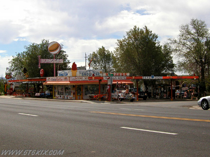
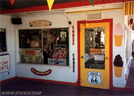
Twister's 50's Cafe in Williams. A definite must-stop for a sandwich and ice-cream. ('99) |

The Twister's sign. ('99) |

Neon outside Twisters. ('02) |

This is why we drive 3000 miles to Williams. ('03) |
|
Click here to view photos and QTVR Panoramas from the
2007 Cool Country Cruise In Festival and Car Show on Route 66 in Williams. |
|
Click here to view photos and QTVR Panoramas from the
2008 Cool Country Cruise In Festival and Car Show on Route 66 in Williams. |

Mmmmmmmmmm. Where does one start? ('03) |

They've got some neat antiques to look at. ('04) |

We met the 66 eGroup at Twisters. Here Ken Turmel (the Landrunner of PostMarkArt fame) demonstrates the finer points of gourmet ice cream consumption to Jim Conkle (of the CA Route 66 Preservation Foundation). ('02) |

Then Ken got up and showed us all how to take photos with "Our Eyes Shut Tight" (with apologies to Dr. Seuss). ('02) |

Then, as a coupe de gras, he gave Jim lessons on how to deal with Lincoln Highway aficionados. ('02) |

The rest of the group stayed out of the antics and finished their sandwiches. ('02) |

Just before we left, some friends from Oatman showed up (sorry I didn't catch their names). ('02) |

Big BBQ (Texas style?) in Williams. ('02) |

Another must-stop. This is the Route 66 Magazine's digs. Check out their gift-shop and subscribe to the 'zine. ('99) Update: they have moved to Laughlen, NV. |
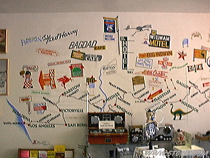
The Route 66 mural inside the Route 66 Magazine's store. ('99) |
..
|
Click HERE to view photos and QTVRs from a Grand Canyon Side Trip
The Grand Canyon has always been associated with Route 66 and is a favorite side trip. The main Park area is about an hour due north of Williams on AZ64. For a better option, leave Flagstaff to the north on US89 and enter the park from the east on AZ64, enjoy the drive along the south rim to the main park area, and then return to Flagstaff via AZ64/US180. This keeps you from having to backtrack inside the park and/or miss the Route 66 alignments between Flagstaff and Williams. . |
..

Welcome to Ash Fork. ('08) |

DeSoto's Barber Shop in Ash Fork. ('08) |

Ash Fork Centennial Park on 66 downtown. ('08) |

West of Ash Fork, 66 comes out from underneath I-40. This is the start of the dead-end portion of 66 that is accessable from the Crookton Road exit off of I-40. ('09) |

66 diverges from I-40 to the south. ('09) |

66 has a raised roadbed and some concrete culverts can be seen in low areas. ('09) |

66 continues west over a rise where someone has used a caboose for a house. ('09) |

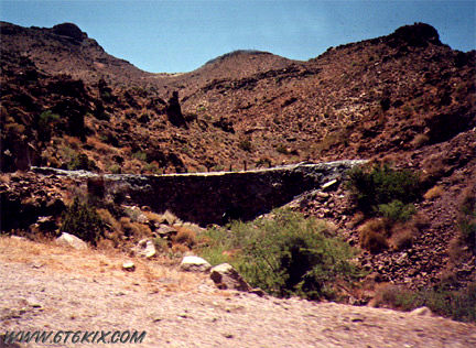
It then decends to Partridge Creek where the Route 66 bridge still exists. ('09) |
|
Panorama of the east end of the Route 66 bridge over Partridge Creek. ('09) |

|
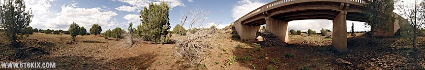
Panorama of the south side of the Route 66 bridge over Partridge Creek. The concrete structure is still in excellent shape. ('09) |

|
Panorama taken from the north side of the Partridge Creek Bridge. |
|
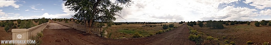
VR Panorama taken from West end of the Partridge Creek bridge. The asphalt approach to this end of the bridge deck has sunk so only higher clearance vehicles should attempt crossing. ('09) |

A view down the hill to the West end of the bridge. ('09) |

A view of the bridge and the caboose house on the far side. ('09) |

a telephoto view of the caboose house. Neat idea but I wonder how they got it there. ('09) |

West of the bridge, the terrain flattens out. The road surface is the original red asphalt ('09) |
|
VR panorama from the middle of 66. ('09) |

|
Another panorama from a little further west. ('09) |

Some portions of the asphalt are in amazingly good condition. ('09) |

Others are really breaking up and really tested my ability to navigate over the broken surface with my low-clearance Mustang. ('09) |
|

A photo of some of the broken-up area. ('09) |

Even the gophers added to the damage. ('09) |
|

Guns on 66: a sign on 66. ('09) |

Nearing the Crookton Road overpass, land sale signs start popping up. ('09) |

At the Crookton Road overpass, 66 is cut by I-40. 66 continues on the North side and diverges as it continues to the west towards Seligman. This is one of the most well preserved segments of 66. ('08) |

At least they have their priorities straight. ('08) |
 |
 |
 |
 |
 |

Bypassed bridge along the current 66 east of Seligman. ('99) |

Side view of the bridge. I couldn't see anything wrong with it. ('99) |

VR Panorama taken from on top of a pile of dirt blocking the end of the bypassed old 66 railroad bridge. ('08) |

VR Panorama taken down between the old 66 bridge and the more modern replacement. The view under the bridge shows the significant repairs it had some point. Looking at the corrosion streaks it is understandable why it was replaced. ('08) |
 |
 |
 |
 |
 |

Coming up to a hill, a piece of bypassed 66 can be seen going to the left around the hill. ('99) |

A closer view from the road. ('08) |
A close up of the bypassed section. There are a lot of pieces of bypassed 66 along this section of Road. ('99) |

Abandoned roadbed on the north side east of Seligman. ('08) |

Westbound on 66 with Seligman in the distance. ('08) |

On the outskirts. ('08) |
Photos from the AZ Route 66 Association's 2008 Route 66 Fun Run
(from Seligman to Kingman) are available in the Events section.
Photos from the AZ Route 66 Association's 2009 Route 66 Fun Run
(from Seligman to Kingman) are available in the Events section.

An interesting billboard entering town. ('08) |

Entering Seligman on main street (the Snow cap is on the left). ('08) |

In the middle of 66 looking east towards the Snow Cap in Seligman. ('04) |

Still in the middle looking west. ('04) |
A view of the Snow Cap. ('04) |

The Snow Cap in Seligman. Dead chicken and all the trimmings (mmm-mmm). ('97) |

The 'Dead Chicken' sign has been updated. ('08) |

The Snow Cap mobile. I guess every day is Christmas in Seligman. ('97) |

I guess windshield eyeballs are 'in' for all old cars now. ('08) |

The newer Snow Cap sign. ('97) |

The original Snow Cap sign. ('97) |
The whole place is out of vaudeville (note the doorknobs, check out the 'Sorry We're Open' sign in the window, and then go back and take a close look at the outhouses). ('97) |

Mr. D doing his shtick for some Brazilian 66'ers. I don't think they caught the humor though (they were taking it all to serious). He used the fake mustard bottle next. ('97) |
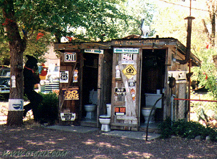
Outhouses behind the Snow Cap. ('97) |

Updated photo of the outhouses. Seems paraphernalia is added all the time. |

Juan's Memorial Garden. ('08) |

The Snow Cap is a Hampton Inn Route 66 Roadside Attraction. ('08) |

A better view. ('08) |
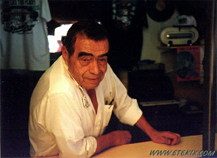
Mr. Juan Delgadillo. ('97) |

VR Panorama taken from the middle of 66 in front of the Snow Cap in Seligman. ('08) |

VR Panorama taken under the east side overhang at Delgadillo's Snow Cap in Seligman. ('08) |

VR Panorama taken in the small memorial park behind the Snow Cap. There are numerous classic vehicles and a small seating area under the trees. ('08) |

Angel's Barbershop and Route 66 Gift Shop. ('97) |

A newer shot of Angel's Barber Shop with a fresh paint-job. ('04) |

Getting a haircut at Angel Delgadillo's Barbershop in Seligman. If anyone qualifies for the term 'Father of the Mother Road' then it is Angel. Stop in and say hi. ('97) |

OK, got one this time where you can see everyone. ('04) |

Inside of Angel and Velma's Souvenir Shop (with Velma behind the counter). ('99) |
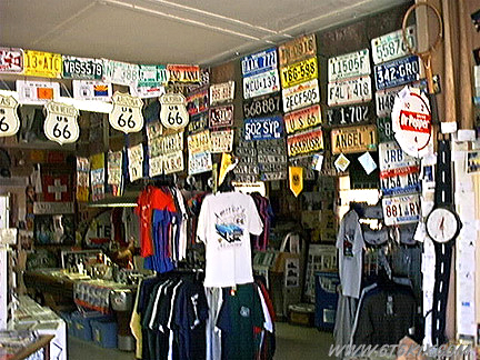
They have an extensive collection of Route 66 memorabilia brought by people from all over the world. Two pool tables are covered by scrapbooks and stuff. ('99) |

Stickers from EVERYWHERE! ('04) |
 A more recent shot of the front of Angel and Velma's Gift Shop. ('99) |

VR Panorama taken from the middle of 66 in front of Angel's Barber and Gift Shop in Seligman. If anyone can be called the father of the Mother Road, Angel would be him. ('08) |

The west side of the Havasu Harvey House in Seligman on April 1st. Unfortunately, BNSF has scheduled it for demolition on April 14th, 2008 and has cut off preservation negotiations. Update: this is now a vacant lot; destruction complete. ('08) |
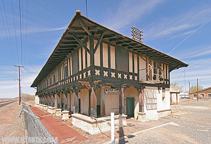
The southwest corner of the Harvey House. ('08) |

The Havasu House also served as the Seligman train station. ('08) |

VR Panorama taken from the parking area on the east side of the Havasu Harvey House in Seligman. |

VR Panorama taken over the fence at the SE corner of the Havasu Harvey House in Seligman. |
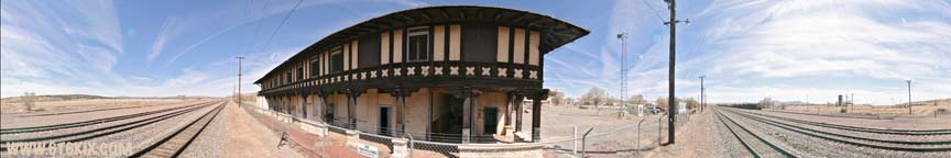
VR Panorama taken over the fence at the railroad side entryway into the Seligman Harvey House. ('08) |

The Route 66 Motel in Seligman. ('97) |

Seligman has many leftovers in the spirit of the Road. This is the Roadkill Cafe sign. ('97) |

The Road Kill Cafe on the west end of Seligman. ('08) |

Seligman welcome sign on the west end of town. ('08) |

Heading west near Peach Springs. If you are a collector of Bob Waldmire's postcards, you probably recognize this shot (no it wasn't intentional, I just noticed it after we got back from our trip). ('97) |

A newer shot of the same spot. ('04) |
|
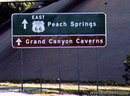
Grand Canyon Caverns west of Seligman. ('04) |
Bypassed piece of 66 going up a hill. ('99) |
Same piece of bypassed 66 coming down the other side. Why this was bypassed didn't seem to make any sense as it is straight and the newer road curves around the hill. ('99) |
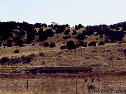
Concrete culvert on bypassed section near Truxton. ('99) |

66 curves down out of the hills east of Hackberry. ('99) |

Bypassed section of 66 ties into current 66 east of Hackberry. ('99) |

One of the many rock cuts along this section of 66. ('97) |

66 and railroad curves through hills east of Hackberry. ('99) |

66 east of Hackberry. ('99) |

They followed the terrain but if it got too close to the railroad, they blasted right through. ('04) |


Another rock cut. ('97) |

We've arrived at one of the neatest places on Route 66. Bob Waldmire used to hang his hat here. ('04) |

The major reason Bob left. The hill behind his center was being systematically stripped of rock to be sold for landscaping. ('99) |

It is spreading to more of the hills in the area. This one is on the south side. ('04) |

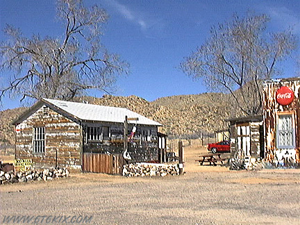
Bob Waldmire's International Bioregional Old Route 66 Visitor Center in Hackberry. Alas, it is but a memory now. ('97) |

A shot from the west, The structure on the left is a solarium made out of recycled windows. ('97) |

A nice piece of Bob's folk art. ('97) |

A desert waiting area out front. ('97) |
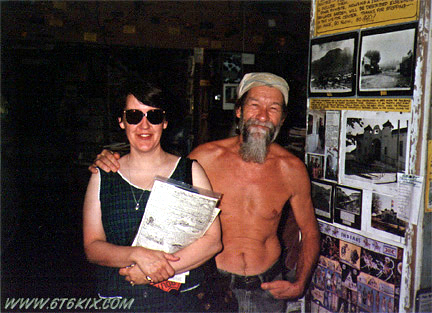
Bob Waldmire and Allison. ('97) |

Bob and Dave (not quite as big a smile though). ('97) |

An original National Old Trails sign. ('97) |

Another sign from Hackberry. ('97) |

An old water bag/ice sign. ('97) |

National Old Trails Road Association marker. ('97) |
 The new Hackberry General store owners are open for business and are returning the building to it's original state. The solarium has been removed from the front of the building and some antique gas pumps have been installed. ('99) |
 Another shot of the compound. Stop in and say hi and have a cold soda. ('99) |
 66 west of Hackberry. ('99) |
 Arizona Route 66 signs along the Road. ('99) |
 66 heading up into the hills North of Kingman. ('99) |
 66 heading north of Kingman. ('99) |

66 heads north out of Kingman passing new developments mixed with old Route businesses. ('99) |

Along Andy Devine Blvd. (66) in north Kingman. ('99) |
Route 66 sign where 66 crosses under the interstate on north side of Kingman. ('99) |

A Welcome sign in Kingman. ('99) |
Photos from the AZ Route 66 Association's 2008 Route 66 Fun Run
(from Seligman to Kingman) are available in the Events section.
Photos from the AZ Route 66 Association's 2009 Route 66 Fun Run
(from Seligman to Kingman) are available in the Events section.
 Route 66 mural in Kingman. ('97) |
 The old 66 deep rock cut south of Kingman. ('97) |
 Heading west across old old 66 towards Sitgreaves Pass and Oatman. ('97) |
 The path of old old 66 can be seen winding its way up the mountain to Sitgreaves Pass. ('97) |
 Ed's Camp on the way up to the pass. ('97) |
 The only Saguaro Cactus we saw the entire trip (I thought these things were supposed to be everywhere in Arizona). I read there was supposed to be two of them here but I could only find this one. ('97) |
Switchbacks on 66 heading up the hill. ('97) |

The path heading up to the pass. ('97) |

Looking east from near the top of Sitgreaves Pass. ('97) |

Another look down from near the top. The 66 switchbacks can be seen etched into the hillsides. ('97) |
|

 Heading back towards Sitgreaves Pass from the Oatman side. For those of you who are wondering what is up with the rainbow, this is what happens when you open the back of your camera to change the film without rewinding it first (Doh!). ('99) |
 Entering Oatman from the east. ('97) |
 The Oatman Post Office. ('97) |
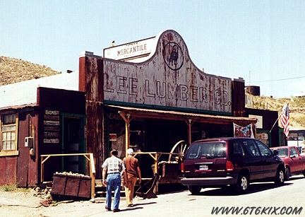
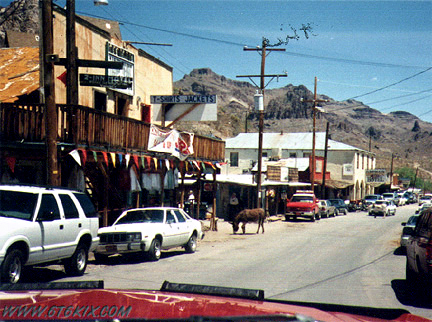 Main Street in Oatman. ('97) |
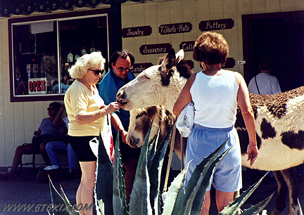
 A shot of one of the many residents of Oatman hiding out in the shade. ('97) |
 Allison and Michelle hanging out with a Donkey. ('99) |

|
|
|

|
 |
 Historic Route 66 National Back Country Byway |
 |
 |

An old Whiting Bros. sign along the newer Route 66 south of Kingman (rather than on the Oatman alignment that heads west through the mountains). ('04) |

Not sure why this was built. I heard it was supposed to be a golf course (golf ball on a tee?) but it is made up with an 'Area 51' theme now. ('04) |

The Needles from the newer 66. ('04) |
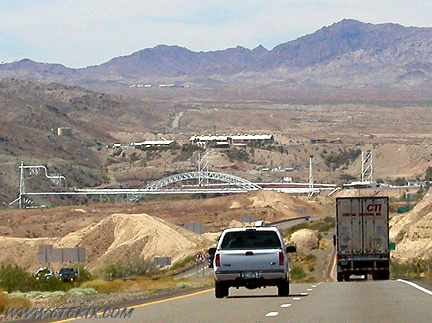
Coming down the hill to the river crossing on newer 66 (I-40). ('04) |

Old 66 bridge over the Colorado. It isn't used for traffic anymore as it now carries a pipeline across. ('99) |
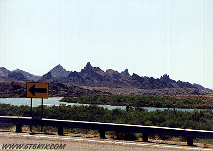
The Needles from the Colorado River crossing. ('99) |
 Another shot of the bridge from the interstate crossing. ('97) |
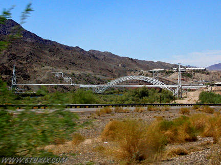
A shot of the bridge from a little better angle. ('04) |
Click HERE to go back to EAST ARIZONA ROUTE 66
|
|
|
|
|
|
|
|
|
..
..
|
|
|
|
|
|
|
|