A 360 Degree Trip Down Route 66

.
This has been a merging of hobbies for me. First, my chemical photography hobby morphed into digital and then merged into my Apple Computer hobby. Then, after I acquired sufficent panoramic technology (camera, lens, etc) to allow the timely generation of QTVR spherical panoramas possible, my Route 66 hobby was rekindled and was merged also. Now I have a hobby of documentation of Old US Route 66 using panoramas, although now technology has continued its march and the format is HTML5.

Below, I have inventoried the panoramas I have produced on 66 in geographic order east to west as if it was being travelled. These are the same panoramas that are in the Route 66 part of this web site but without any normal still photograpy.

I hope you enjoy the 360 degree trip down 66.

.

CALIFORNIA

Cadiz Summit Ruins from the East. ('10)
Click on the photo to view a 360 degree interactive virtual reality panorama.

Cadiz Summit ruins from the North. ('10)
Click on the photo to view a 360 degree interactive virtual reality panorama.

Cadiz Summit ruins from the South along Route 66. ('10)
Click on the photo to view a 360 degree interactive virtual reality panorama.

Cadiz Summit ruins near the stairway up to the main house. ('10)
Click on the photo to view a 360 degree interactive virtual reality panorama.

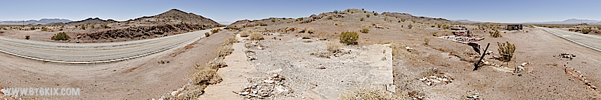
Cadiz Summit ruins from the main house foundation. ('10)
Click on the photo to view a 360 degree interactive virtual reality panorama.

West end of the Cadiz Summit ruins. This area had cabins. The excavation in the hill is where the cooler was. ('10)
Click on the photo to view a 360 degree interactive virtual reality panorama.

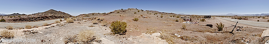
Halfway up the hill above the Cadiz Summit ruins. ('10)
Click on the photo to view a 360 degree interactive virtual reality panorama.

View from the sidewalk along the top of the retaining wall in the main house patio area. ('10)
Click on the photo to view a 360 degree interactive virtual reality panorama.

View of the Cadiz Summit ruins at the top of the stairs up the retaining wall. ('10)
Click on the photo to view a 360 degree interactive virtual reality panorama.

Cadiz Summit ruins from Route 66. ('10)
Click on the photo to view a 360 degree interactive virtual reality panorama.

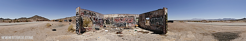
Cadiz Summit auto service building. ('10)
Click on the photo to view a 360 degree interactive virtual reality panorama.

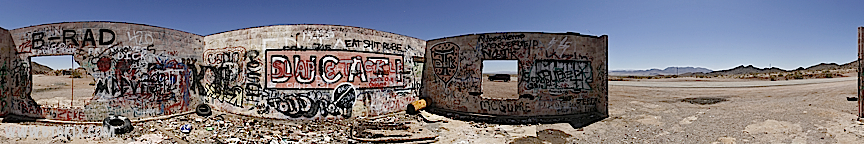
Good view of the graffitti inside the Cadiz Summit ruins auto service building. ('10)
Click on the photo to view a 360 degree interactive virtual reality panorama.

Roy's Cafe and Hotel complex in Amboy. Also the school and Post Office('10)
Click on the photo to view a 360 degree interactive virtual reality panorama.

View of Route 66 from atop the Amboy Crater lava flow west of Amboy. ('10)
Click on the photo to view a 360 degree interactive virtual reality panorama.

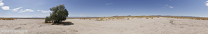
Original location of Bagdad between Route 66 and the railroad tracks.
The only thing left is foundations and the infamous tree. ('10)

Click on the photo to view a 360 degree interactive virtual reality panorama.

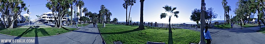
The 'End' of Route 66 in the park at Oceanside and Santa Monica Boulevard.
The brass plaque has been moved somewhat since the last time we were there but it is still there. ('10)

Click on the photo to view a 360 degree interactive virtual reality panorama.

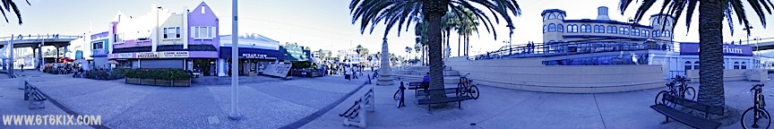
Panorama taken at the base of the pier (the elevated causway can be seen) below the aquarium. ('10)
Click on the photo to view a 360 degree interactive virtual reality panorama.

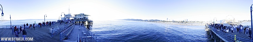
Pole panorama taken on the North side of the pier beyond the amusment park. ('10)
Click on the photo to view a 360 degree interactive virtual reality panorama.

Pole panorama taken on the South side of the Santa Monica Pier. ('10)
Click on the photo to view a 360 degree interactive virtual reality panorama.

.

BACK TO ROUTE 66 PANORAMAS HOME

.
 Route 66
Air Guard
Classic Mustang
Font Factory
Panoramic Photography
Apple Quicktime required to view some content.